
A magnetic GPS tracker combines satellite positioning, cellular communication, battery power, and a protective magnetic case. Its magnet attaches to suitable metal surfaces, while the internal GPS receiver calculates location coordinates. The device then sends those coordinates through a mobile network to an app or monitoring platform.
The magnet is not magic.
Signal quality still depends on sky visibility, antenna placement, network coverage, and battery condition. A tracker placed beneath a vehicle may report less consistently near reinforced metal, underground parking areas, or dense buildings. This practical limitation is easy to overlook.
Industry growth explains the rising interest. IoT Analytics reported approximately 16.6 billion connected IoT devices worldwide in 2023, with the total projected to approach 29 billion by 2030. Grand View Research also estimated strong growth in the global GPS tracking device market, supported by logistics, fleet operations, and asset monitoring. These figures describe a broad technology ecosystem, not only magnetic GPS tracker products.
GPS pioneer Dr. Bradford Parkinson has said, “GPS is a global utility.” That statement captures the technology’s value, but not its responsibilities. A magnetic GPS tracker should support authorized asset protection, fleet coordination, equipment recovery, or family safety with informed consent. It should not become a hidden surveillance tool.
The following guide explains how magnetic mounting, satellite signals, cellular networks, geofencing, and battery systems work together. It also examines accuracy, installation choices, privacy expectations, and common weaknesses. Real-world performance varies. That uncertainty deserves attention.
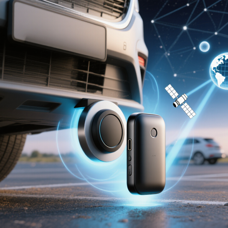
A magnetic GPS tracker is a compact location device inside a protective, magnetized case. It receives signals from navigation satellites to estimate its position. A built-in cellular connection then sends that position to an approved phone or web account. The magnet lets the unit attach to steel surfaces, such as a vehicle frame, equipment cabinet, or storage container. It is not magic. The tracker needs power, signal access, and a suitable mounting surface.
Most units combine satellite positioning, motion detection, and rechargeable batteries. When movement begins, the device may record more frequent location updates. During rest periods, it can enter a low-power mode. This balance affects battery life. In practical use, a clear view of the sky usually improves accuracy. Metal structures, underground areas, dense buildings, and severe weather can weaken positioning performance.
A magnetic case should fit tightly and resist rain, dust, and vibration. Still, no enclosure stays perfect forever. Check the seal and battery before placing it in a demanding environment. I would not treat one location point as unquestionable evidence. GPS accuracy can shift by several meters, and cellular delays may occur. Use tracking only with proper permission and clear communication. That protects privacy and improves the reliability of the information collected.
A magnetic GPS tracker combines several compact electronic parts inside a weather-resistant case. The GNSS receiver reads signals from navigation satellites and calculates the device’s position. It usually needs an antenna, because weak signals can fail inside metal structures or underground areas. The cellular modem then sends location data through a SIM or embedded SIM. No cellular connection, no live update.
A small microcontroller manages these tasks. It controls location intervals, battery use, motion alerts, and stored records. An accelerometer can detect movement when a vehicle begins rolling. The battery supplies power, while charging protection reduces overheating risks. A strong magnet holds the enclosure against a steel surface, but the magnet does not create the location signal. The housing still matters. Water, vibration, and road dust test every seal.
Industry data shows why these components are developing quickly. GSMA Intelligence expects cellular IoT connections to reach 5.8 billion globally by 2030, expanding demand for connected tracking equipment. Grand View Research also reports double-digit growth for the GPS tracking device market through the decade. These figures suggest more compact designs, not necessarily better accuracy. That distinction is easy to miss.
In practical use, place the tracker where it has a clear sky view and stable cellular coverage. Test the alert delay before relying on it. Battery estimates can disappoint in cold weather or poor-signal areas. Use tracking only with proper authorization and transparent notice. A useful device should be technically capable, legally appropriate, and easy to retrieve for charging.
A magnetic GPS tracker uses satellite signals to estimate its position on Earth. The magnetic mount only keeps the device attached to a metal surface. It does not locate the tracker.
The device listens for signals from several GPS satellites orbiting above it. Each satellite sends a precise time and position. The tracker compares those signals and calculates the distance to each satellite. This process is called trilateration. More satellite signals usually improve accuracy. Open outdoor areas often produce better results than parking garages, tunnels, or dense urban streets. Buildings, trees, weather, and electronic interference can weaken the signal. In my experience, location updates may also arrive late when the tracker enters a poor coverage area. That detail is easy to overlook. Cellular networks usually transmit the calculated coordinates to a phone or web platform. Some devices may use nearby Wi-Fi signals to assist positioning. GPS is useful, but it is not perfectly exact.
Tips: Place the tracker where its antenna faces the sky. Check the first location outdoors before relying on later updates. Review timestamps, battery level, and signal status together. A location point without a recent timestamp can be misleading. Keep the device secure, and use tracking equipment only with proper permission.
What Is a Magnetic GPS Tracker and How Does It Work?
A magnetic GPS tracker combines a GNSS receiver, cellular modem, battery, and motion sensor. Its magnet attaches to a steel surface, such as a vehicle frame or equipment cabinet. The receiver collects signals from navigation satellites and calculates latitude, longitude, speed, and time. GPS does not transmit the location itself. The cellular modem sends that data to a secure platform through LTE-M, NB-IoT, 4G, or SMS, depending on network support. Reports may arrive every few seconds during movement or less often to conserve power.
How Does It Transmit Tracking Data?
The device usually follows a simple chain: satellite signal, onboard calculation, cellular upload, then server display. GSMA Intelligence’s The Mobile Economy 2024 reports that global IoT connections could reach 34.4 billion by 2030. That growth reflects wider machine-to-machine communication, including tracking applications. However, this figure does not guarantee coverage everywhere. Underground parking, metal containers, and dense buildings can weaken satellite or cellular signals. I still think “real-time” is often used too casually. A five-minute update is not truly live.
Tips
Choose an update interval that matches the risk and battery size. Test the tracker in its actual mounting location. Check signal strength, temperature, and battery drain for several days. A strong magnet helps, but vibration and rust can loosen the mount. Review access permissions and retention settings. Location data needs careful handling, even when the device is used for legitimate asset management.
Estimated monthly cellular data usage at different location-reporting intervals
A magnetic GPS tracker receives positioning signals from GPS satellites, calculates its location, and sends the coordinates to a remote server through a cellular data connection. This chart uses a 30-day month and an estimated 100-byte position packet per report. It excludes network protocol overhead, acknowledgements, alerts, and map-service traffic, so actual usage may be higher.
A magnetic GPS tracker is a small device with a strong, weather-resistant base. It uses satellite signals to estimate its position, then sends location data through a mobile network. A companion platform displays movement, stops, and battery status. Accuracy can decline near tall buildings, underground garages, or dense tree cover.
These trackers are commonly used on fleet vehicles, trailers, and service vans. A logistics manager may attach one beneath a metal chassis before a long delivery route. Construction teams also place trackers on generators, compressors, and portable tools. The device can show whether equipment reached a worksite or remained parked overnight. Rental businesses may use location data to coordinate returns and maintenance visits, with clear customer notice.
They are also useful for monitoring shared vehicles in large facilities. A security team can check the last known position of an emergency trailer after severe weather. Outdoor organizations may track approved equipment during remote fieldwork. Personal use requires extra care. Tracking another adult without informed consent can violate privacy expectations and local law. Magnetic mounting is convenient, but it is not perfect; vibration, water, weak signals, and drained batteries can create gaps. I would treat every alert as a prompt for verification, not unquestionable proof. Sensor data needs human judgment.
| Data Dimension | Key Point | How It Works or What It Means | Common Applications |
|---|---|---|---|
| Definition | Portable location-monitoring device | A magnetic GPS tracker is a compact tracking unit with a magnetic or magnetic-backed enclosure. The magnet helps attach the device to a compatible ferromagnetic surface, while the electronic components determine and report its location. | Vehicles, trailers, equipment, containers, and other movable assets |
| Positioning Technology | GPS or multi-constellation GNSS | The receiver calculates its position from signals transmitted by navigation satellites. Devices may also use other satellite constellations, such as Galileo, GLONASS, or BeiDou, to improve availability in suitable conditions. | Outdoor asset location and route monitoring |
| Data Transmission | Cellular, Wi-Fi, Bluetooth, or local storage | The positioning receiver finds the location, but a separate communication method is needed to share it. Cellular models send data through a mobile network; some devices use short-range connections or store records for later retrieval. | Remote tracking dashboards, local recovery, and offline logging |
| Magnetic Mounting | Fast, non-permanent attachment | The magnet can make installation easier without drilling holes or using permanent brackets. Holding strength depends on the magnet, surface material, surface condition, vibration, weather, and the tracker's weight. | Temporary vehicle installation, rental assets, and field equipment |
| Location Accuracy | Usually measured in meters outdoors | Open-sky positioning is generally more accurate than positioning near tall buildings, indoors, underground, under dense foliage, or inside metal structures. Accuracy varies with satellite visibility, antenna design, signal conditions, and device quality. | Fleet oversight, asset location, and trip history |
| Update Frequency | Configurable reporting interval | Trackers may report continuously or at scheduled intervals. More frequent updates can provide a more detailed route but normally increase battery use and data consumption. | Real-time alerts, periodic asset checks, and route reconstruction |
| Power Supply | Rechargeable or replaceable battery | Battery life depends on reporting frequency, network availability, temperature, satellite reception, and sleep-mode settings. A tracker with a longer reporting interval generally consumes less power. | Unpowered trailers, machinery, containers, and temporary deployments |
| Geofencing | Virtual boundary alerts | A geofence is a digital boundary created around an area. The system can generate an alert when the tracker enters or leaves that boundary, subject to positioning and communication availability. | Restricted areas, storage yards, delivery zones, and equipment sites |
| Movement Detection | Accelerometer-based activity sensing | Many trackers use an accelerometer to detect motion, stops, impacts, or prolonged inactivity. Motion-triggered operation can reduce unnecessary transmissions and help identify unexpected movement. | Theft alerts, idle-asset monitoring, and usage records |
| Weather Resistance | Enclosure protection varies | Outdoor models may be sealed against dust and water, but protection depends on the enclosure rating and installation conditions. Water resistance does not necessarily mean the device is suitable for submersion or high-pressure washing. | Outdoor vehicles, construction equipment, boats, and cargo assets |
| Common Use | Vehicle and fleet monitoring | A tracker can record vehicle locations, travel history, stops, and movement events. Fleet managers may use this information for dispatching, asset utilization, route review, and recovery support. | Cars, vans, trucks, trailers, and service vehicles |
| Common Use | Construction and industrial equipment | Portable equipment can be monitored when it is moved between worksites or stored outside. Magnetic mounting is useful when a permanent installation is impractical, provided the attachment remains secure. | Generators, compressors, lifts, machinery, and tools |
| Common Use | Trailers and shipping containers | Trackers can help show the last reported position of unpowered mobile assets and provide movement or departure alerts. Metal structures may affect satellite or cellular reception, so installation location matters. | Cargo trailers, storage containers, and transport equipment |
| Common Use | Rental and shared assets | Temporary installation allows organizations to monitor the location and return movement of equipment without making permanent modifications. Access to tracking data should be limited to authorized users. | Rental machinery, recreational equipment, and shared vehicles |
| Key Limitations | Signal, battery, attachment, and privacy constraints | GPS signals can be weakened indoors or around obstructions, cellular reporting requires network coverage, batteries eventually need maintenance, and magnets may not adhere to non-metallic or unsuitable surfaces. Tracking should comply with applicable laws and consent requirements. | Pre-installation assessment, regular maintenance, and responsible use |
Note: Actual performance depends on the tracker design, satellite visibility, cellular coverage, mounting position, environmental conditions, reporting settings, and local regulations.
